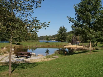
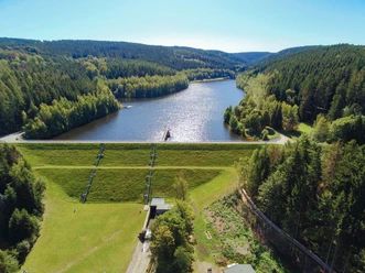
Muldenberg Reservoir Circular Route


- 1:45 h
- 6.77 km
- 62 m
- 62 m
- 700 m
- 755 m
- 55 m
Via the Erzgebirge-Vogtland ridge route you have connection to the extensive hiking trail network of the region.
Waypoints

Good to know
Best to visit
suitable
Depends on weather
Tour information
Loop Road
Stop at an Inn
Directions & Parking facilities
Parking
Parking lot available near the dam.
Public transportation
By Vogtlandbahn from Zwickau or Plauen towards Klingenthal to Muldenberg-Flößerplatz. Information on arrival by bus and train is available from the Vogtland Tourism and Transport Center at www.vogtlandauskunft.de / 03744 19449
Author
Vogtland - Sinfonie der Natur
Organization
Vogtland - Sinfonie der Natur
License (master data)
Vogtland - Sinfonie der Natur

Nearby


Download GPX file