Once through the Devil's Ditch


- 3:15 h
- 13.25 km
- 60 m
- 60 m
- 659 m
- 700 m
- 41 m
- Start: Otterfing
- Destination: Otterfing
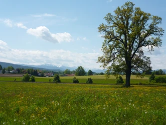
This easy hike leads through forest and fields around Otterfing with not many elevation meters but all the more beautiful panorama. Along the way there are several places to stop for refreshments, so you can recharge well on the relatively long 13 km route.
Good to know
Best to visit
- suitableDepends on weather
Tour information
Familiy-Friendly
Loop Road
Loop Road
Stop at an Inn
Author
Regionalentwicklung Oberland
Organization
Alpenregion Tegernsee Schliersee
License (master data)

Nearby


Download GPX file