- Photos & Map
How would you like to arrive?
- Description
- Waypoints
- Good to know
- Nearby
- 1:07 h
- 4.28 km
- 26 m
- 49 m
- 373 m
- 408 m
- 35 m
- Start: Gunzenberg Campsite Pöhl Reservoir
- Destination: Altensalz
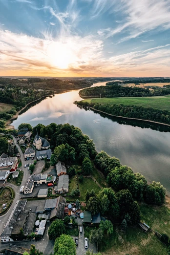
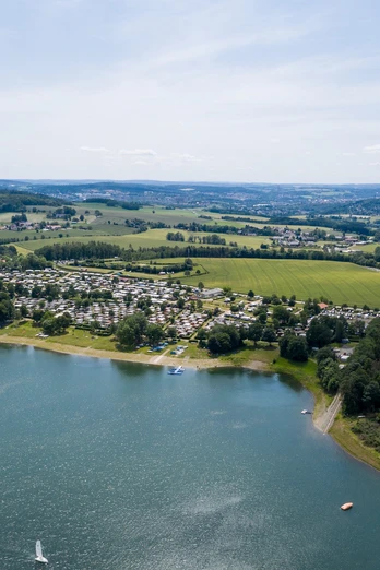
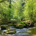
During the approx. 5 km hike along the reservoir circular route, you will mainly walk along the shore of the Pöhl Reservoir.
First, you cross the **** Gunzenberg Campsite. Families already have the opportunity here to stop at one of the newly designed playgrounds. There is also the first dining option here.
After leaving the campsite, you continue hiking towards the Voigtsgrün permanent campsite. Following the shore, you reach Altensalz. On site, you will find another inn as well as the on-demand stop of the passenger shipping service.
Waypoints
Good to know
Pavements
Best to visit
Directions
The route starts at the parking lot of the **** Gunzenberg Campsite. First, you walk approximately 500 m across the campsite, pass the two playgrounds of the campsite, the inn "zur Auszeit," and finally reach a parking lot. You cross this to stay on the reservoir circular path. You follow the hiking trail for about 800 m until you walk a short distance along Gansgrüner Street. Then turn left again onto the hiking trail that leads to the shore of the Pöhl Reservoir. Along the shore, you now walk about 1.5 km towards the Voigtsgrün permanent campsite. Here you will find a small bakery, a public toilet, the dragon boat dock, and another of the newly designed recreational areas at the Pöhl Reservoir - the playground in Voigtsgrün with many new play equipment. After that, you walk about 600 m further along the shore of the Pöhl Reservoir to finally reach Altensalz.
In Altensalz, the church with its church park invites you to rest, relax, and recharge. You can also finish the route at the Altensalz country inn.
Directions & Parking facilities
From the A 72 coming from Bavarian Vogtland, please take the Plauen-East (7) exit and from Chemnitz the Treuen (8) exit and follow the signs to the Pöhl Reservoir.
Use the paid parking lot at the Gunzenberg Campsite.
Bus stop Jocketa Gunzenberg
Bus stop Altensalz Warte
Here you can find more information about the timetable.
Additional information
Boarding and alighting at the on-demand stop is only possible from May 1 to September 30.
A telephone reservation is required.
Departure times and further information can be found here.
Author
Tourismus Marketing Gesellschaft Sachsen mbH
Organization
Zweckverband Talsperre Pöhl
License (master data)
Zweckverband Talsperre Pöhl
Author´s Tip / Recommendation of the author
Boarding at the on-demand stop is possible upon prior arrangement.
Nearby
