


- 5:05 h
- 19.13 km
- 342 m
- 330 m
- 523 m
- 651 m
- 128 m
- Start: Ginsberger Heide (near Hilchenbach-Lützel)
- Destination: Lahn source near Netphen
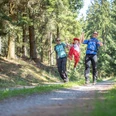
On this stage, the Rothaarsteig leads from the roof of Siegerland into the source area of three large rivers: Lahn, Sieg, and Eder. On this tour, the Rothaarsteig roughly follows the course of the historic Iron Road over the Rothaar ridge. The Iron Road was part of the medieval road from Cologne to Leipzig and owes its name to the fact that iron goods were traded here until the High Middle Ages.
From the Ginsberger Heide it goes to the Ginsburg, which is accessible today as a viewing tower. Shortly afterwards, the Rothaarsteig leads over the Giller (653 m) and further into the source area of three large rivers: Eder, Sieg, Lahn. First, the distinct moor landscapes along the Eder appear. From there, the Rothaarsteig leads eastwards over the Coal Road to Benfe and further to the source of the Sieg. After a redesign in 2014, the source has become a natural spring area again. The namesake of Siegerland flows after 155 kilometers into the Rhine. Another three kilometers on the Rothaarsteig and the goal of the sixth stage is reached: the source of the Lahn. Like the Sieg, the Lahn also flows into the Rhine, but only after 246 kilometers of river course.
Good to know
Best to visit
Tour information
Stop at an Inn
Author
Rothaarsteigverein e. V.
Organization
Touristikverband Siegen-Wittgenstein e.V.
License (master data)

Nearby
