- 83:55 h
- 295.50 km
- 5,948 m
- 5,844 m
- 19 m
- 352 m
- 333 m
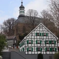
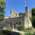
Opened in May 2022, the Cistercian Way is a 6,300 km long European cultural hiking trail that leads through six European countries. The trail connects the 17 monastery landscapes of the Cisterscapes network and touches numerous other attractive sights along the way. It leads through unspoilt landscapes that boast culinary specialities and architectural treasures The trail is oriented towards Cîteaux in Burgundy, the cradle of the order, where all abbots met for the general chapter.
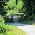
The Cistercian Trail runs along existing, already marked hiking trails. In the Bergisches Land region, it runs along the Bergischer Weg. Small detours repeatedly lead to other elements of the monastery landscape. The Cistercian Way is not marked with its own signposts. Please orientate yourself with the help of the gpx data, hiking maps or the markers of the hiking trails used.
Only the section from Kamp to Heisterbach is shown here, as this section of the route leads through the Bergisches Land. Information on the entire trail can be found here.
Good to know
Best to visit
suitable
Depends on weather
Author
Das Bergische GmbH - Bergisches Haus
Friedrich-Ebert-Straße 75
51429 Bergisch Gladbach
Organization
Das Bergische GmbH - Bergisches Haus
License (master data)
Das Bergische GmbH - Bergisches Haus

Nearby