- 8:59 h
- 30.32 km
- 767 m
- 770 m
- 480 m
- 840 m
- 360 m
- Start: Moosgassstrasse, Triengen
- Destination: Moosgassstrasse, Triengen
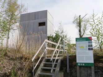
Four marked observation decks offer magnificent views. Enjoy the peaceful natural surroundings, whether hiking uphill to the highest point in the “Sämirain” area at 835 meters above sea level, or along the Sure River in the valley floor at 500 meters above sea level. The trail is well-marked, and you can choose to hike shorter sections.
Several bus stops in Triengen will take you back to the starting point or to train connections in the Surental valley to Sursee or Schöftland. Taking breaks on benches and visiting farm stands make the hike even more enjoyable. Signs and information about points of interest off the trail are available.
Experience the diverse natural scenery and relaxation while hiking in Triengen!
Best to visit
- suitableDepends on weather
Tour information
Familiy-Friendly
Labelling
Documents
License (master data)