


- 2:45 h
- 9.49 km
- 117 m
- 117 m
- 328 m
- 445 m
- 117 m
- Start: Niederberndorf
- Destination: Niederberndorf
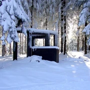
The easy to moderate route leads scenically from Niederberndorf in the Schmallenberger Sauerland through the Wenne valley to Menkhausen. On the opposite hillside, it returns via Landenbecker Hof back to Niederberndorf. Above the village, you can again overlook a large part of the hike.
Good to know
Best to visit
Directions
If we encounter a hunting stand there, we must turn sharply left and follow the path NB1 towards Menkhausen. We turn left twice at the paved road and reach the village Menkhausen. Here, we cross the Wenne stream and district road 32. Beyond that, we turn immediately left, following NB1 into the "Königsallee" and gradually climb out of the village, always following the path and NB1 on the paved road, then turn left and reach the Hardebusch farmstead.
We continue straight ahead, turn right at the junction, following the path sign ME1, and later reach a country road. We have to go about 250 meters left over it and again turn left at the first turn (path without sign, sign water supply facility). Now we follow a small paved road to the few houses of Landenbecker Bruch. Before the first house, we go left to the edge of the forest, then right, and follow X25. Our path continuously leads along the forest edge and offers splendid views into the Wenne valley towards Niederberndorf and over a part of the Hawerland. When we meet the NB1 marking at a crossroad, we turn right and gradually descend the hillside, returning to our starting point Niederberndorf.
Tour information
Loop Road
Equipment
Directions & Parking facilities
For timetable information: www.rlg-online.de
With theSchmallenberger Sauerland Card you can travel free by bus and train in the region.
Author
Tourist-Information Schmallenberger Sauerland
Organization
Schmallenberger Sauerland Tourismus
License (master data)

Author´s Tip / Recommendation of the author
Safety guidelines
In the Hochsauerland district, a rescue point system is installed. You can find rescue points among others on the information boards at junctions and hiking signs.
Map
Hiking map Schmallenberger Sauerland, scale 1 : 25,000
Nearby