Walenpfad

- 4:05 h
- 11.19 km
- 561 m
- 671 m
- 1,598 m
- 1,953 m
- 355 m
- Start: Bannalp (Oberrickenbach)
- Destination: Ristis (Engelberg)
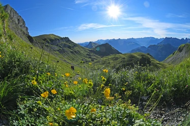
The hike starts at the Bannalp mountain station with the ascent to Walenegg – the highest viewpoint of the Walenpfad. Near the end of the route, tired hikers can refresh themselves at the Brunnihütte with an Älperzneyni. On the “Kitzelpfad” around the nearby Hätzli lake, you wade over moor, gravel, wood chips, and stones and enjoy the tingling feeling of natural relaxation. Afterwards, a short descent to Ristis follows (chairlift as an alternative).
Good to know
Pavements
- Unknown (2%)Trail (16%)Path (82%)
Best to visit
- suitableDepends on weather
Tour information
Nature Highlight
Author
Nidwalden Tourismus
Organization
Nidwalden Tourismus
License (master data)
Nidwalden Tourismus