- 1:29 h
- 19.26 km
- 12 m
- Start: Tourist information
- Destination: Tourist-Informarion
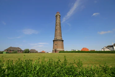
The route to the harbor in the district of Reede starts at the tourist information office on Georg-Schütte-Platz and initially runs along Deichstraße. After turning into Süderstraße, follow it in the direction of the electric lighthouse. From there, turn onto Emsstraße, then onto Randzellstraße and then onto Greune Stee.
From there, continue straight on towards the harbor, where not only the DGzRS sea rescuers are stationed, but also the BORKUMRIFF National Park lightship provides interesting insights into one of the most exciting periods in German maritime history and the Lower Saxony Wadden Sea National Park.
You can take the same route back to the town or return via Reedestraße, Deichstraße, Süderstraße and the promenade.
From there, continue straight on towards the harbor, where not only the DGzRS sea rescuers are stationed, but also the BORKUMRIFF National Park lightship provides interesting insights into one of the most exciting periods in German maritime history and the Lower Saxony Wadden Sea National Park.
You can take the same route back to the town or return via Reedestraße, Deichstraße, Süderstraße and the promenade.
Best to visit
- suitableDepends on weather
Author
Organization
Nordseeheilbad Borkum GmbH
License (master data)
Nordseeheilbad Borkum GmbH