Cross-border hike from Schmilka to the Prebischtor

- 4:05 h
- 10.20 km
- 504 m
- 475 m
- 121 m
- 451 m
- 330 m
- Start: Schmilka
- Destination: Prebischtor
Schmilka – Hřensko – Prebischtor
Good to know
Pavements
- Unknown (23%)Asphalt (4%)Gravel (28%)Trail (3%)Path (42%)
Best to visit
- suitableDepends on weather
Directions
- In Schmilka, the tour begins at Bergsteig and leads up to the Grenzweg (marked with a yellow line). About halfway along the Grenzweg, the trail branches off to the right: a newly created, well-marked cross-border hiking trail leads over to Hřensko.
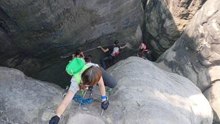
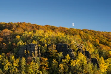
The ascent takes you up numerous steps to a plateau. At the top, beautiful views open up time and again—especially of the Zirkelstein and the Kaiserkrone. At the same time, the traces left by the 2022 forest fire become visible here: large areas of damage from which young birch trees are now regrowing. As the vegetation becomes denser, the views will gradually be obscured again in the coming years.
Once you arrive in Hřensko, follow the road for a short distance until you reach the “Gabrielensteig” turnoff. This is where the ascent to the Prebischtor begins. It’s worth allowing plenty of time to visit the various lookout points at your leisure. Important note: An admission fee is charged at the Prebischtor.
Option 1: It is recommended to take bus line 435 back to Schmilka; the bus stop is located on the main road immediately after the descent from the Prebischtor.Option 2: If you’d like to extend the tour, you can plan a detour to the Phönix Lookout (an additional approx. 3.5 km to Mezna). It was erected as a symbol of nature’s rebirth following the 2022 forest fire and uses images and information panels to illustrate nature’s regenerative powers. From there, walk to Mezna, where you can also take bus line 435 back to Hřensko.
Option 3: The return trip follows the same route back to Schmilka.
Option 4: Or you can hike to the Elbe River in Hřensko and take the hiking boat (operating from Easter through the end of October) for your return trip to Schmilka.
GPS data updated in 2026 Tour information
Cultural Interesting
Stop at an Inn
Tour with Dog
Equipment
- Sturdy footwear required
Directions & Parking facilities
- Getting thereBy car from Dresden via the A17 to Pirna, then the B172 and the connecting roads from Königstein to Bad SchandauParkingSchmilka Border Crossing Parking Lot (fee required)Public transportationDirections:
Bus line 252 – Stop: Schmilka, border crossing
or
Bus line 435 Hřensko, Mezná
For more information and schedule details: https://www.vvo-online.de/de/fahrplan/fahrplanauskunft/index.cshtml
https://www.vvo-online.de/de/tarif-tickets/tarif/Fahrten-in-den-Bezirk-Usti-5444.cshtml
https://www.idecin.cz/de/touristenlinie-durch-den-nationalpark
or
Schmilka Ferry - S-Bahn Line S1
Departure:
Bus Route 435 to Hřensko, stop at Pravcicka brana (Prebischtor), then back to the stop: Schmilka, border crossing
https://www.vvo-online.de/de/tarif-tickets/tarif/Fahrten-in-den-Bezirk-Usti-5444.cshtml
https://www.idecin.cz/de/touristenlinie-durch-den-nationalpark
Sightseeing boat Additional information
- Bad Schandau Tourist Information: +49 (0) 35022 900 50
Hřensko Tourist Information: +42 0 412 528 344
Accommodation providers with the "Hiker-Friendly on the Malerweg" certification along Stage 5
Hiking with a dog:
The hike should be easily manageable with a dog. However, at the Prebischtor, some viewpoints may only be accessible with a dog via metal staircases.
Literature
- Order Now:Online Store - Hiking Guides
Author
Madlen Rogge
Organization
Tourismusverband Sächsische Schweiz
License (master data)
Madlen Rogge

Author´s Tip / Recommendation of the author
- After the 5th stage on the Malerweg, the hike to the Prebischtor along the cross-border trail, with Schmilka as the starting and ending point, is highly recommended for those wishing to follow in the footsteps of the historic Malerweg. So it’s best to plan for an extra night in Schmilka before continuing on to Stage 6.
Safety guidelines
- Please note: In national parks, you may only use marked trails.
Attention: Check for detours at: https://www.saechsische-schweiz.de/gut-zu-wissen/aktuelles or at: https://nationalpark-saechsische-schweiz.de/wegeservice
Map
- Buy here: Online Store for Hiking Maps