- 17:07 h
- 60.89 km
- 1,166 m
- 1,089 m
- 134 m
- 385 m
- 251 m
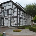
- Start: City center, Brakel
- Destination: Wewelsburg Castle, Büren
The Nethe-Alme Trail crosses the mountain range. From the heights of the Brakel shell limestone threshold, the trail first leads in a westerly direction through the largest eastern excavation trench of the mountain range, which is crossed at Herbram-Wald.
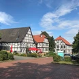
In the western Längstal valley, the route crosses the Sauer, Altenau and Alme rivers, which cut through the Paderborn plateau. The route was chosen so that those interested in history and culture also get their money's worth.
Good to know
Best to visit
suitable
Depends on weather
Tour information
Multiday Tour
Directions & Parking facilities
Coming from Paderborn, you can reach Brakel via the B64 and then via the B252.
Parking spaces available nearby.
Hikers' parking lot: at the railroad embankment.
Hikers' parking lot: at the railroad embankment.
By train: "Brakel" stop.
By bus: "Stadtmitte" stop in Brakel.
By bus: "Stadtmitte" stop in Brakel.
Nahverkehrsverbund Paderborn/Höxter
Always know what's running: The smart number for buses and trains in NRW 01803 504030 (timetable information for €0.09/min from a German landline, mobile max. €0.42/min)
Author
Kreis Paderborn | Wirtschaft & Tourismus
Königstraße 16
33142 Büren
License (master data)
Kreis Paderborn | Wirtschaft & Tourismus

Safety guidelines
Sturdy shoes recommended.
Nearby