Around the Castle


- 0:35 h
- 2.24 km
- 16 m
- 16 m
- 299 m
- 313 m
- 14 m
- Start: Castle Rammenau Parking Lot
- Destination: Castle Rammenau Parking Lot
The hiking route, just over 2 km long, is largely barrier-free and therefore also ideal for outings with strollers and small children.
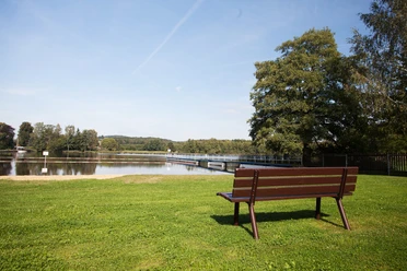
Along the route around the castle, you pass the sheep pond and the wash pond, the demonstration beehive, and the Peace Oak. The parking lot at the castle can be used as the start and finish point.
Good to know
Pavements
- Unknown (37%)Asphalt (20%)Gravel (19%)Trail (23%)
Best to visit
- suitableDepends on weather
Tour information
Cultural Interesting
Loop Road
Loop Road
Suitable for Pushchair
Tour with Dog
Author
Region Westlausitz
Organization
Das Landschaftswunderland Oberlausitz
License (master data)
Region Westlausitz

Nearby

Download GPX file