Around the Fockenstein (Route No. 43 from the "RadlTraum Süd")


- 5:00 h
- 34.29 km
- 1,142 m
- 1,142 m
- 676 m
- 1,334 m
- 658 m
- Start: Bad Wiessee Söllbach parking lot
- Destination: Bad Wiessee Söllbach parking lot
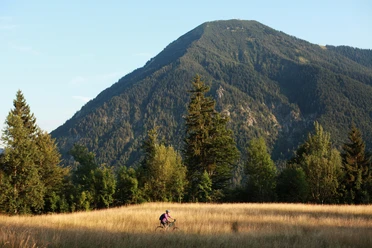
The only connecting route through the mountains of the Tegernsee valley with the Isar valley and Lenggries. Over dreamlike alms it goes up to 1340m and down to 679m. A longer route, which is perfect for exploring the mountains east of the Isar. The views of the Tegernsee do not take long to appear, the summit of the Fockenstein (a distinctive mountain seen from the Tegernsee) is not necessary here and the Tegernsee awaits a cool down after the strains of the route.
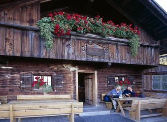
Refreshment options available.
Good to know
Best to visit
suitable
Depends on weather
Tour information
Loop Road
Loop Road
Stop at an Inn
Author
Regionalentwicklung Oberland
Organization
Alpenregion Tegernsee Schliersee
License (master data)

Nearby

Download GPX file