Circular route in the Gande valley (RW5)

- 3:00 h
- 10.13 km
- 149 m
- 151 m
- 109 m
- 195 m
- 86 m
- Start: Parking lot Hildesheimer Straße (spa area) (127 m) Coordinates: Geographic 51.874466 N 10.033894 E UTM 32U 571174 5747581
- Destination: Same as start
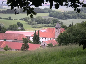
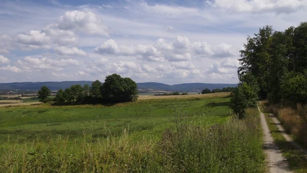
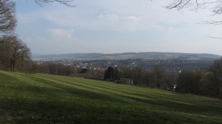
Before the path reaches our first destination, the Lahberg landscape conservation area, it offers an opportunity to get to know the historic old town of Bad Gandersheim a little. From Lahberg, the view then extends over the typical, gently hilly cultural landscape of the Harz foreland. From here, we can already see our next destination, the small village of Orxhausen. It lies picturesquely on the Gande, which meanders in many loops through the valley here. After leaving the village, the path ascends a bit on the edge of the forest on the Wadenberg. Before we enter the forest, it is worth looking back to enjoy the beautiful distant view. Initially through the magnificent deciduous forest and later through the fields, our route soon reaches the town again.
Good to know
Best to visit
Tour information
Stop at an Inn
Author
Heinz Schrader
Organization
Harz: Magische Gebirgswelt
License (master data)

Nearby