Dream trail Beckinger Saarblicke


- 4:05 h
- 14.76 km
- 278 m
- 278 m
- 171 m
- 365 m
- 194 m
- Start: Beckingen station, Bahnhofstraße, 66701 Beckingen
- Destination: Beckingen station
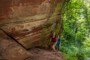
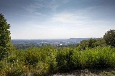
Behind the old station complex, which houses the information center for the Wolferskopf nature reserve, the path rises 200 meters in altitude to the Fischerberghaus. Old bunkers stand along the path. Along the way is an old limestone quarry with a lime kiln. From the terrace of the Fischerberghaus high above the Saar, there is a magnificent view into the Saar valley. The four-way junction is the highest point of the hike. The view is breathtaking: the Saar valley spreads out, behind it the Lothringer Stufenland, the Litermont, the Wahlener Plateau, the Black Forest High Forest, the Schaumberg, the Siersburg, Ensdorf and Dillingen. The emblem of the nature reserve at Wolferskopf is a very rare grasshopper: the Wart-biter. More than 450 plant species grow in the nature reserve, including various orchid species, the yellow asparagus bean, and the fringed gentian. On the descent, the path runs along the historic 1778 border between the Kingdom of France and the Electorate of Trier. Powerful sandstone border stones recall that time.
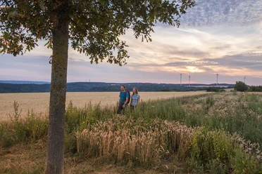
In Haustadt, a restored Westwall bunker can be visited. The path leads back to Beckingen through the Kondelerbachtal. Along the old Saar river arm one reaches the Saar and shortly after the Saar Garden Beckingen. An open-design park was created on an area of 32,000 square meters.
The path was rated with 63 experience points by the German Hiking Institute.
Good to know
Best to visit
Tour information
Cultural Interesting
Loop Road
Loop Road
Stop at an Inn
Author
Frank Polotzek
Organization
Saarland
License (master data)

Nearby
Download GPX file