Trail loop The Bietzerberger


- 5:45 h
- 18.55 km
- 382 m
- 382 m
- 176 m
- 393 m
- 217 m
- Start: Lower Mühlental at L 174 (500 meters from Fremersdorf station), Saarmühlenstraße, 66663 Merzig (or at the inn "Fischerberghaus"; Wendelinusstraße, 66701 Beckingen)
- Destination: Lower Mühlental
During the Second World War, nearly 200 bunkers were built on the Bietzerberg, which belonged to the fortifications of the Westwall. Some of these – mostly demolished bunkers – stand directly by the trail.
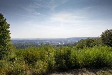
Between Bietzen and Menningen, in every viewpoint axis, are fruit trees in the scattered orchards laid out around the villages. At the "Triangular Grove" stands the stone sculpture "Sonnenstein" by Prof. Paul Schneider, which is part of a group of twelve stone sculptures on the Bietzerberg. On the plateau of the mountain, the path leads to the viewpoint "Saarlouiser Berg", one of the most beautiful panoramic views in Saarland.
In the Bietzer forest, the Bietzerberger meets the nature experience trail "WilderWaldWeg", which runs over long wooden walkways, unpaved forest paths and trails.
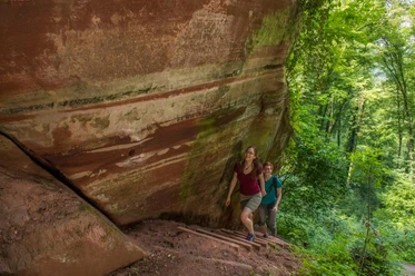
In the Wolferskopf nature reserve are stone witnesses of the German-French past. The path runs partly on the historic border from 1778.
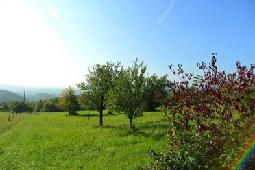
On a flower meadow at the forest edge, where orchids bloom in early summer, further fabulous views into the Saar valley. On the sun bench in the Wolferskopf nature reserve, another impressive view into the Saarlouiser basin and flower meadows.
The path was rated by the German Hiking Institute with 71 experience points.
Good to know
Best to visit
Tour information
Loop Road
Loop Road
Stop at an Inn
Author
Frank Polotzek
Organization
Saarland
License (master data)

Nearby
Download GPX file