E.ON Bayern Trail at Schliersee


- 1:45 h
- 7.27 km
- 17 m
- 23 m
- 776 m
- 793 m
- 17 m
- Start: Schliersee
- Destination: Schliersee
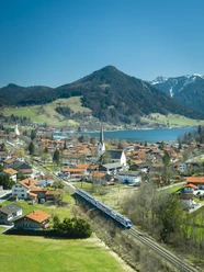
Over almost 7 km, the route leads once around Schliersee. Passing the campsite, various bathing spots, and boathouses, you walk towards the end through the village, where one or another shop window invites you to stop.
Good to know
Best to visit
- suitableDepends on weather
Tour information
Barrier-Free
Loop Road
Loop Road
Stop at an Inn
Author
Regionalentwicklung Oberland
Organization
Alpenregion Tegernsee Schliersee
License (master data)

Nearby


Download GPX file