E.ON Bayern Trail at Spitzingsee


- 1:45 h
- 7.00 km
- 65 m
- 65 m
- 1,026 m
- 1,091 m
- 65 m
- Start: Spitzingsee
- Destination: Spitzingsee
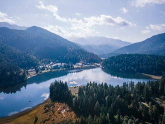
Against a dreamlike mountain backdrop, this route takes us past well-known huts and accommodation houses such as the Albert-Link-Hütte or the Blecksteinhaus once around the Spitzingsee and further into the idyllic Valepptal.
Good to know
Best to visit
- suitableDepends on weather
Tour information
Loop Road
Loop Road
Stop at an Inn
Author
Regionalentwicklung Oberland
Organization
Alpenregion Tegernsee Schliersee
License (master data)

Nearby


Download GPX file