BicycleBUS route: Over Bohemian rock peaks to the Elbe


- 4:45 h
- 67.43 km
- 299 m
- 713 m
- 112 m
- 718 m
- 606 m
- Start: Tisá cultural house – access to the Tissaer Walls or stop Jílové Sněžník restaurant Hraničář - ascent to Sněžník/Snow Mountain
- Destination: Station or ZOB Pirna
The route can be started with a visit to the Tyssaer Walls. Then in Tisá descend and follow the wide hairpin bend to Sněžník (cycle path 21).
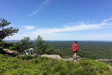
Tip: In Sněžník, first go straight uphill about 2 kilometers to the High Snow Mountain (Sněžník) (or push). Here, you will first find on the left side of the summit the Dresden viewpoint (Drážďanská vyhlídka) and then the observation tower and a small cabin with refreshment options. The return trip back to the village of Sněžník leads back along the same path.
Then ride through the village of Sněžník and continue following "cycle path 23" through a longer forest section towards Maxičky (Maxdorf). After a descent (caution, somewhat steeper descent!), you reach the Elbe via the Děčín suburb of Připeř, which is called Labe on the Czech side.
Follow the cycle path downstream along the Elbe to Schöna, and the route can then continue on the Elbe cycle path to Pirna.
Alternatively, you can get on the S-Bahn line 1 at any point along the Elbe cycle path, which will bring you back to Pirna.
Good to know
Pavements
- Street (28%)Asphalt (67%)Gravel (2%)Trail (2%)Path (1%)
Best to visit
- suitableDepends on weather
Tour information
Stop at an Inn
Directions & Parking facilities
- ParkingPublic transportation
Arrival:
BicycleBUS 217 from Pirna ZOB (bus station) via Berggießhübel and Bahratal, on all weekends and public holidays between April 1 and October 31.
BicycleBUS 242/246 from Königstein Reißiger Platz/station via Leupoldishain and Rosenthal-Bielatal, from Rosenthal the bus continues as BicycleBUS 217 to Tisá, on all weekends and public holidays between April 1 and October 31.
BicycleBUS 245 from Pirna via Leupoldishain, Bielatal to Rosenthal, footpath to Schneeberg or continue as line 217 via Jílové Sněžník and Tisá to Pirna, on all weekends and public holidays between April 1 and October 31.
Departure:
National Park Railway U28 from Děčín to Bad Schandau or further via Sebnitz to Rumburk
S-Bahn S1 (Schöna - Meißen Triebischtal), including from Bad Schandau, Königstein, Kurort Rathen and Pirna
Author
Touristinformation Bad Gottleuba-Berggießhübel
Organization
Tourismusverband Sächsische Schweiz
License (master data)
Touristinformation Bad Gottleuba-Berggießhübel

Author´s Tip / Recommendation of the author
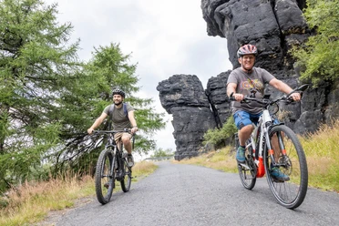
The BicycleBuses run on all public holidays and weekends from April 1 to October 31. They can transport up to 16 bicycles at the same time. Bringing e-bikes is not a problem. Your advantage: overnight guests with the guest card mobil only need to buy a bike ticket. This can be bought from the bus driver.