From Beerheide to the six ways and seven ways - Route 3 Beerheide

10.98 km long
Round trip
Difficulty: medium
Condition: medium
Great panorama
Hiking
  • 2:55 h
  • 10.98 km
  • 147 m
  • 171 m
  • 626 m
  • 738 m
  • 112 m
  • Start: Hiking car park at the forest sports ground Beerheide
  • Destination: Hiking car park at the forest sports ground Beerheide
Beautiful hike from Beerheide to the six and seven ways

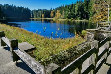
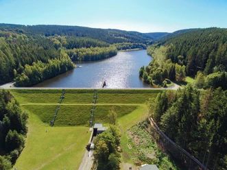
Starting from the hiking car park at the forest sports ground in Beerheide, begin your hike. After crossing Klingenthaler Straße towards Jägerwiesenweg, hike to the Sechs Wege junction, where you can take your first rest. Via the Sandigen Weg you reach the Sieben Wege junction, where you can also rest and enjoy the magnificent forest and tranquility. Your path then leads you to Jungfernsprung along the Zinsbach upstream to the Grünheide forest park. Here, especially the little hiking friends have a lot to discover and can refresh themselves at the cafeteria "WaldHaus." Continue hiking via Frankenweg to the Old Coffee House, from where you cross Siedlung street and continue downhill to Rempesgrüner Straße, reaching the village square and from there continue via Buchenweg and Straße des Friedens to the hiking rest area. From here, it’s only a few meters back to the hiking car park, the starting point of your hike.

Waypoints

Start
Hiking car park at the forest sports ground Beerheide
Destination
Hiking car park at the forest sports ground Beerheide

Good to know

Best to visit

suitable
Depends on weather

Directions

Hiking car park – crossing Klingenthaler Straße – turn left to Jägerwiesenweg to the Sechs Wege junction – via Sandigen Weg to the Sieben Wege junction – Jungfernsprung – along the Zinsbach stream upstream – turn left at Pfaffenweg to the Grünheide forest park (sports halls) – through the forest park – after the forest park area turn left to district road K 7826 – left via Frankenweg to the Old Coffee House – connecting path to Siedlung street – crossing Siedlung street and continue downhill to Rempesgrüner Straße – turn right onto Rempesgrüner Straße to the village square – across the village square turn left onto Straße des Friedens – via Buchenweg – Straße des Friedens – at the hiking rest area turn right onto the path along the forest edge – after 250 m turn left to the sports field – along the sports field to the hiking car park

Tour information

  • Loop Road

  • Stop at an Inn

  • Tour with Dog

Equipment

sturdy footwear

Directions & Parking facilities

Beerheide is located in the southwest of the Free State of Saxony. The nearest larger towns in the area are Plauen, Zwickau, and Reichenbach. Beerheide can be reached conveniently via the A72 motorway. Motorway exit: A72 Treuen, exit towards Treuen and from there continue on B169 towards Auerbach, then onto S300 towards Klingenthal or motorway exit: A72 Plauen Ost, exit onto B173 towards Falkenstein and from there on B169 to Auerbach, then S300 towards Klingenthal
There are 90 parking spaces available at the hiking car park at the forest sports ground in Beerheide, or you can park in one of the public parking lots in the village of Beerheide
Information about arrival by bus and train is available from the Vogtland Tourism and Transport Centre at www.vogtlandauskunft.de or via the hotline 03744 19449.

Additional information

www.erholung-vogtland.de/Aktiv/Wandern

www.beerheide-vogtland.de

Literature

Brochure "Hiking routes around Beerheide" available at the Vogelsgrün Guest House or the Auerbach Tourist Information

Author

Claudia Gerisch

Organization

Vogtland - Sinfonie der Natur

License (master data)

Claudia Gerisch
License: Attribution, ShareAlike

Author´s Tip / Recommendation of the author

Shelter at the Sechs Wege junction / Sieben Wege junction picnic possible

Vogtland lake - swimming possible in good weather

Rest at Grünheide forest park Cafeteria "WaldHaus"

Nearby

Contact

From Beerheide to the six ways and seven ways - Route 3 Beerheide
08209 Auerbach/Vogtland