From the Hercules Columns to the Moorteich in the Saxon Switzerland Landscape Protection Area


- 3:45 h
- 11.42 km
- 299 m
- 305 m
- 346 m
- 508 m
- 162 m
- Start: Bushaltestelle Schweizermühle
- Destination: Bushaltestelle Schweizermühle
Schweizermühle – Herkulessäulen – Johanniswacht – Ottomühle – Mehlsteig – Moorteich – Hirschstange – Zauschengrund – Diebsgrund – Alte Rosenthaler Straße – Sachsenstein – Nachbar – Schweizermühle
Good to know
Pavements
- Street (2%)Asphalt (26%)Gravel (36%)Trail (11%)Path (26%)
Best to visit
- suitableDepends on weather
Directions
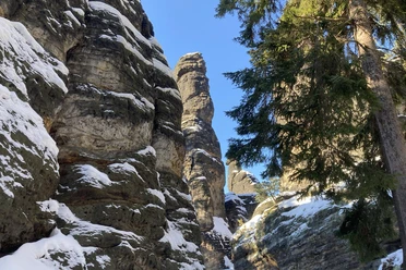
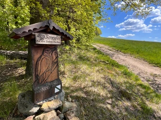
- We start heading south along the Korbfeilenweg until we discover the markings of the Forststeig (yellow vertical stripe) on the left side. We follow this past the Hercules Columns and the Johanniswacht. Via the green dot, we go into the valley and have the opportunity to refresh ourselves at the snack bar. After a successful refreshment, we go via the Glasergrund (blue stripe) to the Mehlsteig until we cross the Hirschstange and then follow it to the Moorteich. At the Moorteich, you can learn about the typical plants in this biotope area. The return path leads us over the Hirschstange, Zauschengrund, Diebsgrund to the old Rosenthaler Straße. On this path, we can still enjoy a few rock formations. The old Rosenthaler Straße leads us directly to the Sachsenstein, where you can reach the viewpoint via ladders. Finally, we follow the Forststeig northwards to the "Nachbar" and then descend to the bus stop. Attention! Attention! The Forststeig also goes into the valley, but does not lead us to the bus stop, so follow the blue stripe!
Tour information
Loop Road
Stop at an Inn
Summit
Directions & Parking facilities
- Getting thereAb Königstein der Beschilderung in Richtung Bielatal folgen, dann Richtung Rosenthal/Schweizermühle/Ottomühle. Der Parkplatz Schweizermühle befindet sich direkt an der Straße. Ein Stück den Korbfeilenweg entlang in Richtung Ottomühle liegt linker Hand der Parkplatz Ottomühle.Parking
Car park Schweizermühle
Capacity: approx. 20 car spaces
Ticket price: subject to a fee
Car park Ottomühle
Capacity: approx. 40 car spaces
Ticket price: 3€ day ticket car
Public transportationStop: Schweizermühle
242: Bielatal Line: Königstein-Rosenthal- Schneeberg-Tisa and back
245: Bielatal Line: Pirna- Leupoldishain- Rosenthal and back
Additional information
- Weitere Infos zu Schutzgebieten in der Nationalparkregion
- Sicher wandern in der Sächsischen Schweiz, Tipps erstellt in Zusammenarbeit mit der Bergwacht
- Regeln im Landschaftsschutzgebiet
Author
Amrei Voigt
Organization
Sachsenforst I Nationalpark- und Forstverwaltung Sächsische Schweiz
License (master data)
Amrei Voigt

Author´s Tip / Recommendation of the author
- The snack options at Schweizer- and Ottomühle are recommended. The route is suitable for active children and dogs, except for the views.
Safety guidelines
- The views at Sachsenstein and Johanniswacht are not suitable for dogs and small children.
Nearby


Download GPX file