- 4:40 h
- 13.87 km
- 551 m
- 694 m
- 873 m
- 1,405 m
- 532 m
- Start: Menzberg
- Destination: Luthern Bad
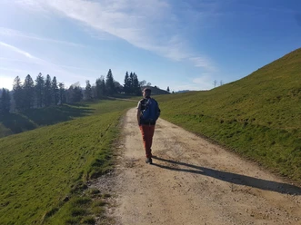
The hike starts in Menzberg, the highest village in the Napf region. Along a gentle ridge trail, it passes through forests and meadows up to the Napf. There, an impressive panoramic view opens up over the Alps, the Central Plateau, and as far as the Black Forest. After a well-deserved rest, the path continues towards the pilgrimage site Luthern Bad. The descent is varied and scenically appealing. A detour to the Badbrünneli, a small spring with a chapel and the arm and foot bath, is worthwhile before the post bus takes us to Zell train station.
Pavements
- Street (1%)Asphalt (14%)Gravel (7%)Trail (78%)
Best to visit
- suitableDepends on weather
Tour information
Stop at an Inn
Summit
Tour with Dog
Author
Willisau Tourismus
Organization
Willisau Tourismus
License (master data)
Willisau Tourismus