Mulde hiking trail Glauchau - Penig


- 7:00 h
- 27.49 km
- 183 m
- 222 m
- 204 m
- 301 m
- 97 m
- Start: Glauchau Reservoir
- Destination: Penig Center
Without breaks, it takes about seven hours to complete the picturesque route.
The hiking trail starts at the Glauchau reservoir and ends in the center of Penig.
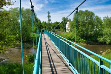
The Zwickauer Mulde river is a constant companion throughout.
By the way: The path passes by the former castle gate of Waldenburg Castle, which was the entrance gate until the castle fire in 1619. Since the 18th century, it left its original location and has since been the entrance gate to the Grünfelder Park.
Waypoints
Start

Destination
Good to know
Best to visit
suitable
Depends on weather
Author
Julia Keller
Organization
Tourismusverband Chemnitz Zwickau Region e. V.
License (master data)
Julia Keller

Nearby