Nature experience hike between Zeisigstein and Hartenstein


- 3:00 h
- 10.00 km
- 117 m
- 117 m
- 439 m
- 547 m
- 108 m
- Start: Markersbach bus stop "Gasthaus zur Linde" or Markersbach hiking car park
- Destination: Markersbach bus stop "Gasthaus zur Linde" Markersbach hiking car park
Markersbach hiking car park - Buchenhain forest nature trail - Kochemoor - Zeisigstein - Hartenstein - Markersbach hiking car park
Good to know
Pavements
Best to visit
Directions
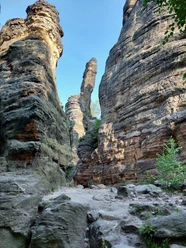
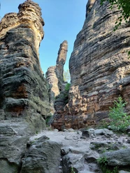
From the starting point, you can follow the newly created Buchenhain forest nature trail (unmarked) and learn a few educational things. Then continue along a wide forest road to the Kochemoor protected natural area. After that, follow the forest trail marking towards Zeisigstein. Zeisigstein, at 551m, is the third highest elevation in Saxon Switzerland. After a rest at Zeisigstein, continue along the forest trail to the second viewpoint: Hartenstein. You reach this via an iron bridge. From there, it goes back to the Markersbach hiking car park or the bus stop.
Tour information
Cultural Interesting
Loop Road
Equipment
Directions & Parking facilities
Via Königstein, Langhennersdorf to Bahra.
Markersbach hiking car park (approx. 20 cars).
Arrival and Departure:
Bus line 247 (Mon-Fri) or 218 (Mon-Fri)
Stop: Markersbach "Gasthaus zur Linde"
On weekdays, it is advisable to arrive by bus 242 or 218 and get off/on at the Markersbach "Gasthaus zur Linde" stop.
On weekends, the car is the best choice with the starting point at the Markersbach hiking car park.
Additional information
Author
Madlen Rogge
Organization
Tourismusverband Sächsische Schweiz
License (master data)
Madlen Rogge

Author´s Tip / Recommendation of the author
The hike is especially recommended in spring.
Safety guidelines
CURRENT [April 2025]: Closure in the Kochemoor area until May 16, 2025. A detour recommendation can be found here.
In winter, forestry work and hunting may take place here. Please observe the on-site instructions.
Nearby


Download GPX file