Saar-Mosel-Hochwald route


- 7:00 h
- 192.05 km
- 1,535 m
- 1,531 m
- 142 m
- 437 m
- 295 m
- Start: Merzig station
- Destination: Saarbrücken station
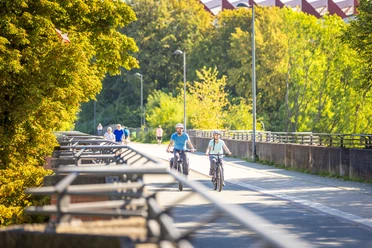
The route can be started directly from St. Johanner Markt in Saarbrücken. Over the Alte Brücke it goes in a north-easterly direction directly to the Saar cycle path. The first section on the flat riverside path in the direction of Merzig can be considered a warm-up phase. Alternatively, you can also conveniently take the train to Merzig and start the route there. From there it continues more demanding. You steadily climb out of the Saar valley up to the heights of Saargau before descending into the Moselle valley. After a short flat section on the Luxembourg side of the Moselle, it goes over Rhineland-Palatinate back into Saarland, where a climb into the Hochwald awaits. Through varied hill terrain, it finally goes across Saarland back to Saarbrücken.
Good to know
Best to visit
Tour information
Cultural Interesting
Loop Road
Loop Road
Stop at an Inn
Author
Frank Polotzek
Organization
Saarland
License (master data)

Nearby

Download GPX file