- 2:20 h
- 9.01 km
- 110 m
- 101 m
- 266 m
- 321 m
- 55 m
- Start: Walkenried station, Bahnhofstraße 1, 37445 Walkenried
- Destination: Walkenried station, Bahnhofstraße 1, 37445 Walkenried
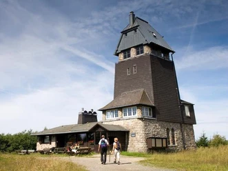
An easy hike along the Andreas, Sack, and Brun ponds past the Sachseneiche, the Helbing hut, to the Sachsenstein hut (stamp 166) leads you further past the Loren monument in Neuhof to the historic gypsum kiln (stamp 192). Then further via the Mehholz viewpoint, to Kutzhütte and along the Höllsteinklippen cliffs back to the station in Walkenried.
Best to visit
- suitableDepends on weather
Tour information
Cultural Interesting
Loop Road
Loop Road
Author
Harzer Tourismusverband
Organization
Harz: Magische Gebirgswelt
License (master data)