Three Castles Route


- 2:05 h
- 8.15 km
- 52 m
- 43 m
- 226 m
- 277 m
- 51 m
- Start: Klippenstein Castle in Radeberg
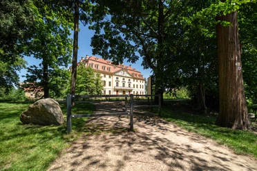
- Destination: Seifersdorf Castle
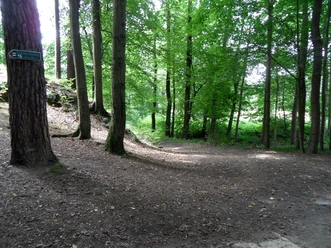
The hiking trail is an alternative route to the Lusatian Snake between the municipality of Wachau and the town of Radeberg, essentially a route variant with a cultural background. It connects Radeberg's Klippenstein Castle, the Baroque castle in Wachau, and Seifersdorf Castle near the Seifersdorf Valley. The path is consistently marked with a red dot.
Good to know
Pavements
- Street (18%)Asphalt (15%)Gravel (11%)Trail (39%)Path (17%)
Best to visit
- suitableDepends on weather
Tour information
Cultural Interesting
Author
Region Westlausitz
Organization
Das Landschaftswunderland Oberlausitz
License (master data)
Region Westlausitz

