- 0:50 h
- 2.81 km
- 18 m
- 18 m
- 1,083 m
- 1,098 m
- 15 m
- Start: Spitzingsee east shore parking lot
- Destination: Spitzingsee east shore parking lot
The Spitzingsee, one of the highest and largest mountain lakes in Bavaria by area, offers a breathtaking natural landscape. At an elevation of 1084 m above sea level, it offers a lot: from classic gastronomy to huts and alpine pastures to cable cars, some of which also operate in winter. It lies idyllically nestled in a basin between Brecherspitz and Rotwand.
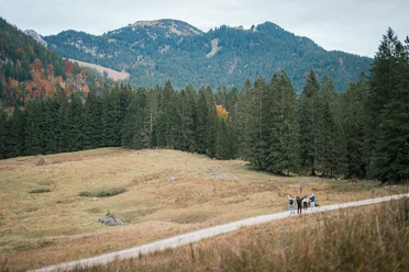
Many hikes start here: for example to Jägerkamp, Rotwand, Bodenschneid, or Brecherspitz. But also a wonderful path around the Spitzingsee is possible. It is flat, without major altitude differences, and thus suitable for everyone.
Also possible in winter, although slippery conditions and risk of falling are to be expected.
This path has been tested as an accessible hiking trail according to the criteria of 'Travel for all'. Further information is available here.
Best to visit
- suitableDepends on weather
Tour information
Barrier-Free
Cultural Interesting
Familiy-Friendly
Loop Road
Loop Road
Stop at an Inn
Suitable for Pushchair
Author
Regionalentwicklung Oberland
Organization
Alpenregion Tegernsee Schliersee
License (master data)