Around the Rotwand (route no. 12 from the "RadlTraum Süd")


- 4:00 h
- 40.96 km
- 672 m
- 671 m
- 750 m
- 1,147 m
- 397 m
- Start: Bayrischzell (alternative Spitzingsee)
- Destination: Bayrischzell (alternative Spitzingsee)
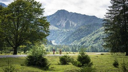
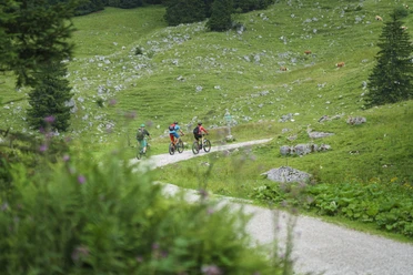
The Rotwand is the highest mountain in the Tegernsee-Schliersee Alpine region. Circumnavigating it by mountain bike is one of the highlights of the region. From normal paved roads over larger forest roads to smaller less frequently used forest roads, this route offers variety. Besides fantastic viewpoints and beautiful valleys, this circular route includes several places to stop for refreshments, especially around Spitzingsee, Aurach, Geitau, Osterhofen, and Bayrischzell.
Attention: from April 15 to May 15 the forest road over the Elendsattel is closed to all nature users to protect a mating and breeding area of the capercaillie.
Good to know
Best to visit
Tour information
Loop Road
Loop Road
Stop at an Inn
Author
Regionalentwicklung Oberland
Organization
Alpenregion Tegernsee Schliersee
License (master data)

Nearby
Download GPX file