Circular route VG Münchenbernsdorf 1 - Saara-Markersdorf-Schafpreskeln-Hohe Reuth-Großbocka-Schöna


- 6:32 h
- 24.44 km
- 413 m
- 413 m
- 244 m
- 381 m
- 137 m
- Start: Gasthaus Hohe Reuth
- Destination: Gasthaus Hohe Reuth
While the first part of the route leads through villages, meadows, and fields, the last part is characterized by constant ups and downs in a wide forest area. There are dark forests interrupted by bright clearings where you might encounter deer or, if lucky, mouflons.
Waypoints

Good to know
Pavements
- Street (6%)Asphalt (13%)Gravel (53%)Trail (28%)
Best to visit
- suitableDepends on weather
Directions
The path begins at the Gasthaus Hohe Reuth. Here you follow the signposts towards Münchenbernsdorf and walk on a forest road to Kamphaus. At the crossroads, follow the signpost towards Bockaer Grund. In Bockaer Grund, a signpost points to Großbocka (1.2 km / Käseberg 8.5 km). The path briefly follows the road to Kleinbocka to the right and then turns left at a bungalow settlement and continues on a small paved road to Großbocka.
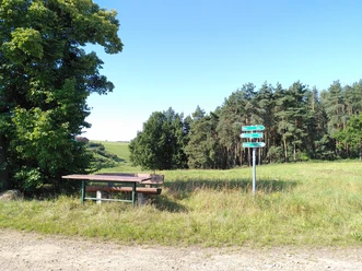
After passing the entrance sign of Großbocka, follow the signpost to the left after a short descent, past the pond until a wide valley opens to the right. From there, continue on the path towards Schöna. The path leads through a beautiful meadow valley past willow trees. Shortly after a small rest area with a bench "Im Wiesengrund Bocka," you can choose between the meadow path and the forest path to Schöna. While the meadow path runs flat in the valley bottom along the edge of the forest, the forest path winds as a narrow trail slightly higher with gentle ups and downs through the forest towards Schöna. Shortly before Schöna, you see the small settlement Kanada on the left, and shortly after, the meadow and forest paths meet again and continue as a single path towards Schöna.
In Schöna, the path turns right. You follow the stream to the Gasthof Schöna. There a signpost points towards Großsaara 2.5 km / Käseberg 4.5 km. The path leads over a forest road through the woods to Großsaara. Upon leaving the forest, you can already see the church of Saara and look towards Käseberg. Follow the path into the village and keep right along the main street. The path passes the bus stop and shortly afterward turns right towards Markersdorf.
It goes uphill into the forest and continues on a forest road. Upon leaving the forest, you can already see the church of Markersdorf. From the village entrance, follow the signpost towards Weißig. The path leads through the small village with beautiful half-timbered houses past the village pond and then turns right with a slight ascent on an old farm road up to the forest.
After leaving the forest, you can already see Weißig. Here the path goes downhill into a meadow valley before ascending, first gently and then steeper, to Weißig on the other side of the valley. From here you have a beautiful view back over meadows and valleys. You cross the former federal highway 2 and follow the path into the village. At the village pond, the path turns right and continues towards Schafpreskeln.
You follow an old farm road again down into a meadow valley with a beautiful view of old orchard meadows. The path winds through meadows and soon leads somewhat steeply uphill to a small road, which you follow briefly towards Gorlitzsch. Before reaching the village, the path goes downhill to the right into another valley with willow trees and orchard meadows and then uphill to Schafpreskeln.
In Schafpreskeln, keep right and follow the road through the village uphill. At the village exit, continue following the road towards Sirbis. From the highest point, you can look far over the land. The lightly trafficked road goes downhill into the valley. From there, follow the path towards Zedlitz.
In Zedlitz, a historic cherry avenue leads right up to the forest. Follow the adjoining forest road. Soon a small marked path (red dot) branches off to the left. Follow this path first gently and later quite steeply downhill. Upon reaching the valley, keep right and follow the forest path to the fork where you keep left and continue on the forest road. At the next fork, keep right.
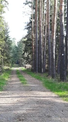
From now on, follow the signposts towards Hohe Reuth. The path gently ascends through the forest, past small forest meadows and streams. Towards the end, you reach the fork "Am Schwalbengrund." There the path turns right and it is not far to the starting point "Hohe Reuth."
Tour information
Loop Road
Stop at an Inn
Tour with Dog
Equipment
- Sturdy footwear
Directions & Parking facilities
- Getting there
The hiking trails of the municipal association Münchenbernsdorf are located near the Hermsdorfer Kreuz, i.e. near the A4 and A9 motorways.
From the Lederhose exit (A9), follow the B175 towards Gera and from Großebersdorf, continue on the former B2 towards Gera. The Gasthaus Hohe Reuth, which is the starting point of the route, is located directly on the former B2.
ParkingParking is available directly at the Gasthaus Hohe ReuthPublic transportationThe starting point can be reached by public transport.
Bus, line Gera – Schleiz, stop Kleinbocka
Literature
Hiking guide Gera and surroundings
ISBN 978-3-86636-160-7, 2nd edition from 2020
Verlag Grünes Herz
Author
Vogtland - Sinfonie der Natur
Organization
Vogtland - Sinfonie der Natur
License (master data)
Vogtland - Sinfonie der Natur

Author´s Tip / Recommendation of the author
- Visit to the small village Kanada
Map
Gera 1 : 50 000 hiking map
ISBN 978-3-86636-030-3
Verlag Grünes Herz
Nearby


Download GPX file