Circular route VG Münchenbernsdorf 4 - Eichert forest area and view over the land


- 3:20 h
- 12.68 km
- 197 m
- 197 m
- 308 m
- 389 m
- 81 m
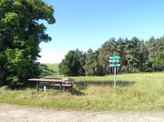
- Start: Rest house Hohe Reuth
- Destination: Rest house Hohe Reuth
The route leads through the Eichert forest area near Münchenbernsdorf and through the villages Lederhose and Kleinbocka.
You should plan 3 – 4 hours. While the first part of the route runs in and around the forest, the second part follows small roads from which you repeatedly have wide views over the countryside.
Good to know
Pavements
Best to visit
Directions
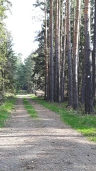
The path begins at the forest road towards Münchenbernsdorf opposite the guesthouse Hohe Reuth. Here you follow the small path (nature trail) to the left towards Großebersdorf parallel to the road. After a short time you reach a forest road and follow it downhill to the right towards Großebersdorf. The path continues to follow the nature trail and on display boards you repeatedly learn interesting facts about the forest and its inhabitants.
Soon you reach the Finstergrund with a small rest area and a beautiful view towards Großebersdorf.
The path continues straight out of the forest and along the edge of the forest down into the valley. At a former small pond the path turns right towards Münchenbernsdorf and goes briefly uphill along the forest edge. After a short time you reach the Frauenstein with interesting information about history.
The path continues through an old oak stand past small ponds back into the forest and then begins a longer ascent on a forest road. The path continues straight ahead to the junction with the covered rest area "Am Steintisch". Here the path turns left towards "Lederhose".
From now on you follow the forest road "Eichertstraße". You pass the "Biereiche" (left) and shortly afterwards it goes downhill towards Lederhose.
At the edge of the forest you cross the road and follow the cycle path to the right past one of many ponds where water birds can often be observed. You now reach Lederhose and follow the village street to the guesthouse Lederhose where you turn right towards Münchenbernsdorf.
The path is now a foot and cycle path and leads uphill past the Gewerbegebiet Lederhose before shortly afterwards going down into the valley towards Münchenbernsdorf. From the height you have a beautiful view of Münchenbernsdorf and if you look back you can see far across the Vogtland to the Ore Mountains in clear weather.
You follow the path until the city park with a playground appears on the left. At the city park a path leads uphill to the right towards the sports field through willows and past gardens. Soon the path turns left and you follow the path through the "schöne Aussicht" further towards the sports field. At the sports field a small asphalt road leads to the right around the sports field. From there you have another beautiful view of Münchenbernsdorf and Großbocka. At the end of the road the path turns right onto the road to Kleinbocka.
Now you follow the road downhill into the valley. On the right lies the Eckertsteich pond, where according to legend a White Lady is said to haunt at night. The road leads along the forest and later through a wide valley through meadows past fields slightly uphill to Kleinbocka.
The path leads through the small village past the village fountain, pond, playground, and church. Before it gets a little steeper uphill the road forks. Here you keep right and follow the road straight into the new residential area. Even if the road turns left you continue straight ahead. At the end of the road a meadow path continues uphill to a radio tower and right around the radio tower. From here you can already see the starting point of the route and can look far out into the countryside once more.
Tour information
Loop Road
Stop at an Inn
Tour with Dog
Equipment
Directions & Parking facilities
The hiking trails of the Verwaltungsgemeinschaft Münchenbernsdorf are located near the Hermsdorfer Kreuz, i.e., near the motorways A4 and A9.
From the Lederhose exit (A9) follow the B175 towards Gera and from Großebersdorf the former B2 further towards Gera. Directly on the former B2 lies the guesthouse Hohe Reuth, which is the starting point of the route.
The hiking route can be reached by public transport.
Bus, line Gera – Schleiz, stop Kleinbocka
Alternatively at the start in Münchenbernsdorf: Bus, line Gera – Münchenbernsdorf, bus stop Münchenbernsdorf
In Gera there is a connection to the Central German regional rail network.
Literature
Hiking guide Gera and surroundings
ISBN 978-3-86636-160-72. Edition of 2020
Verlag Grünes Herz
Author
Vogtland - Sinfonie der Natur
Organization
Vogtland - Sinfonie der Natur
License (master data)
Vogtland - Sinfonie der Natur

Author´s Tip / Recommendation of the author
Map
Gera 1 : 50 000 hiking map
ISBN 978-3-86636-030-3
Verlag Grünes Herz
Nearby


Download GPX file