- Photos & Map
How would you like to arrive?
- Description
- Waypoints
- Good to know
- Nearby
Download GPX file
- 5:20 h
- 20.38 km
- 286 m
- 286 m
- 244 m
- 381 m
- 137 m
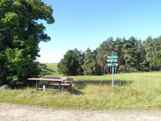
- Start: Hiking parking lot Burkersdorf
- Destination: Hiking parking lot Burkersdorf
The circular route starts at the hiking parking lot near Burkersdorf and leads over Seifersdorf and Zedlitz through beautiful small valleys, past the legendary horse’s head, and past the inn Hohe Reuth, which invites you to a short break.
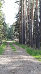
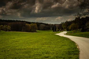
From here it continues on a nature trail through the "Finstern Ground" to the Großebersdorf ponds. At the outskirts of Großebersdorf, the Frießnitzer See - Struth nature reserve is directly adjacent. Here you can admire water buffalo among numerous bird species.
In Frießnitz itself, you have the opportunity to refresh yourself or indulge gastronomically at the inn "Zur Quelle" or the Sachse ice cream café.
Then it goes on scenic paths past the "Schwarzer Teich" which invites to swim in summer, back to the starting point.
Waypoints
Good to know
Pavements
Best to visit
Directions
- Start at the parking lot outside the town next to the Burkersdorf golf course, plenty of parking spaces, seating available, from here start to the right on the connecting road Seifersdorf-Burkersdorf parallel to the golf course,
- follow the marking of a yellow crossbar on a white background
- at the entrance to Nonnendorf leave the paved road, turn right and follow the hiking trail here along the edge of the forest and shortly thereafter turn right onto the forest path towards Seifersdorf
- "Am Brand" reach a paved driveway towards Seifersdorf
- In Zedlitz you have to use the road straight through the village, past the village fountain and shortly after Zedlitz leave the road following the uphill marking: connection Red dot on white background – the asphalted section is done from here
- Reaching the crest there is a clear view towards Gera, from now on it unfortunately gets a bit complicated – the hiking trail in the expected form is no longer available, so at the crossroads turn left, keep the hedge and forest edge on the left side and follow the terrain directly along the forest edge for about 800 m until the Red dot marking on a white background is reached again and it leads into the high forest, continue through the forest and idyllic quiet area
- After a slight ascent a hiking hut invites you to linger and already opens the view into the "Long Valley"
- Here a detour about 200 m to the left to the information board is worthwhile
- At "Am Schwalbengrund" you have the option of taking a detour to the left to the hiking hut with a horse's head – it invites for a short rest
- Following the path further now to the inn "Hohe Reuth" with dining options and a shady spot under old chestnut trees
- After crossing a main road, leave it after about 200 m to the right – junction into Eichertstraße, which however is not used on this route, but from here turn left immediately onto the nature trail heading towards Finstergrund
- Arriving at "Im Finstergrund", a free view of meadows opens, initially leaving the route bordered by forest
- Passing the picturesque Großebersdorf ponds, a large playground awaits the children at the village entrance
- Right next to Großebersdorf begins the Frießnitzer See nature reserve
- Comfortable hiking route on meadow paths between willows and reed grass, explanatory signs about flora and fauna enliven the hike
The view opens here to the impressive water buffalo – a small highlight not necessarily expected here
- The path continues past Friessnitzer See to the edge of the village, those who like can use the inn "Zur Guten Quelle" located to the right in the village for a break or enjoy coffee with ice cream and cake a bit further in the village
- Back on the route cross the main road and follow the left path past a garden area towards the forest edge
- Densely wooded forests and smaller paths lead to the Schwarzer Teich, in which it is indeed possible to take a cool bath in suitable temperatures amidst trees
- A small bungalow settlement to the left of the path, the forest opens and soon the starting point of this quite demanding but very varied circular hike is reached
Tour information
Loop Road
Stop at an Inn
Equipment
Directions & Parking facilities
The hiking trails of the municipal association Münchenbernsdorf are located near the Hermsdorfer Kreuz, i.e. at the A4 and A9 motorways.
From the Lederhose (A9) exit, follow the B175 towards Gera. After the village Großebersdorf, turn right onto B175 towards Greiz/Weida. You pass through Frießnitz and then arrive at Burkersdorf. Here turn left in the village center towards Zedlitz. After leaving the village, you reach the hiking parking lot on the left side.
The route can be started from the inn Hohe Reuth using public transport.
Bus, line Gera – Schleiz, stop Kleinbocka
Literature
Hiking guide Gera and surroundings
ISBN 978-3-86636-160-72. Edition 2020
Verlag Grünes Herz
Author
Vogtland - Sinfonie der Natur
Organization
Vogtland - Sinfonie der Natur
License (master data)
Author´s Tip / Recommendation of the author
Map
Gera 1 : 50 000 hiking map
ISBN 978-3-86636-030-3
Verlag Grünes Herz
Nearby


