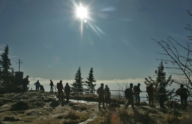
Hiking route 'Sauerklee' (Sorrel) (Spiegelhütte - Gsenget border crossing)

- 2:45 h
- 6.40 km
- 420 m
- 180 m
- Start: Parking area Spiegelhütte, Spiegelhütte 19, 94227 Lindberg
- Destination: Gsenget border crossing
On the 'Sauerklee' (Sorrel) hiking trail, you hike from Spiegelhütte through diverse forests steadily uphill. At a major trail junction with a shelter, you continue towards Schachtenhaus. The 'Sauerklee' (Sorrel) trail ends at Gsenget, a year-round border crossing open to pedestrians and cyclists, leading to the Czech Republic.
Good to know
Best to visit
- suitableDepends on weather
Contact person
Author
Nationalparkverwaltung Bayerischer Wald
Freyunger Str. 294481 GrafenauOrganization
Nationalparkverwaltung Bayerischer Wald
License (master data)