- 2:15 h
- 6.95 km
- 249 m
- 249 m
- 798 m
- 998 m
- 200 m
- Start: Bayrischzell
- Destination: Bayrischzell
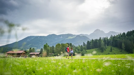
At the foot of the Wendelstein, this loop leads from Bayrischzell over the outskirts to Hochkreuth. Once there, most of the elevation gain is done, as the route then notably descends until you reach Osterhofen. From there, it goes back along the railway line to Bayrischzell to the spa park. Those who reach their limits along the way can also comfortably take the train back from Osterhofen.
Best to visit
- suitableDepends on weather
Tour information
Loop Road
Loop Road
Stop at an Inn
Author
Regionalentwicklung Oberland
Organization
Alpenregion Tegernsee Schliersee
License (master data)