- 1:00 h
- 3.66 km
- 34 m
- 34 m
- 795 m
- 829 m
- 34 m
- Start: Bayrischzell
- Destination: Bayrischzell
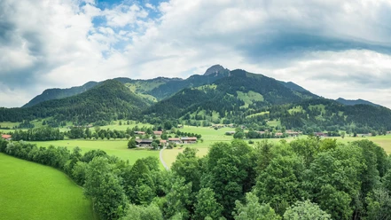
From the center of Bayrischzell, the Melkstatt loop leads us southwards along the valley and brings us back to the starting point in a curve over the Tannerhof. Under good conditions, you can definitely observe the occasional paraglider landing on the Melkstatt meadow on this loop.
Best to visit
- suitableDepends on weather
Tour information
Barrier-Free
Familiy-Friendly
Loop Road
Loop Road
Stop at an Inn
Author
Regionalentwicklung Oberland
Organization
Alpenregion Tegernsee Schliersee
License (master data)