Luchsenburgweg


- 3:15 h
- 12.61 km
- 215 m
- 215 m
- 286 m
- 389 m
- 103 m
- Start: Community Center Parking Lot Ohorn
- Destination: Community Center Parking Lot Ohorn
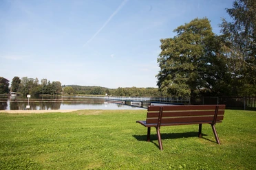
The approximately 13 km long Luchsenburgweg offers an entertaining day hike with several ascents. It begins and ends at the parking lot in front of the community center in Ohorn. The route mainly runs through the Luchsenburg forest area. At the Schwarzen Teich (Black Pond) there is space for rest and relaxation in an idyllic setting. Upon arriving at Tanneberg, you can enjoy a great view of the surrounding area. There is a shelter here and the possibility to barbecue. The Luchsenburg forester's house is a popular excursion inn in the region. In Ohorn, under a residential house, lies the source of the Pulsnitz River. The community center in Ohorn houses the local history museum, which displays historical exhibits from the life of Ohorn residents as well as from the Rödertal valley. A visit to the local history museum is possible by prior arrangement at the Ohorn municipal administration.
The natural route is especially suitable for families with older children.
Good to know
Pavements
- Unknown (8%)Street (2%)Asphalt (14%)Gravel (29%)Trail (39%)Path (8%)
Best to visit
- suitableDepends on weather
Directions
From the parking lot at the community center in Ohorn, follow the green dot with a white L towards Stipendie into the Luchsenburg forest area. The first point reached is the foot of Schleißberg. However, this is not fully walked, but via a large meadow that offers a nice view of Ohorn, the route goes downhill over Stipendie into the Luchsenburg forest. Via Mühlweg and Tellerweg you finally reach the "Schwarzen Teich," a quiet lake with many water lilies. From here, a small path leads to Schweinegrundweg and then to Hochsteinstraße. As the name suggests, this goes uphill to Hochstein, but the Luchsenburgweg heads downhill to the Luchsenburg forester's house. Past this towards Röderbrunn, the hiking trail runs on a small path parallel to the A4 motorway until it crosses under it through a tunnel. The next destination is Tanneberg (385 m above sea level), which guarantees a view as far as the Ore Mountains on clear days. The hiking route back to Ohorn passes by the source of the Pulsnitz and then returns to the starting point at the parking lot.
Tour information
Cultural Interesting
Loop Road
Stop at an Inn
Tour with Dog
Equipment
Sturdy footwear is recommended for the route.
Directions & Parking facilities
- Getting there
You can reach the parking lot in Ohorn via the A4 (from the directions Bautzen/Görlitz and Dresden) exit Ohorn. From there follow the signs towards Ohorn. On Pulsnitzer Straße before the senior residence, turn into Schulstraße and follow it to the community center where the parking is located.
Coming from Pulsnitz, follow Pulsnitzer Straße and after the senior residence turn left into Schulstraße. Follow this to the community center where the parking lot is located.
ParkingThere are plenty of free parking spaces available at the parking lot in front of the community center.
Public transportationTake the bus to the stop "Ohorn Schule" or "Ohorn Hauptstraße." Details on available connections can be found on the website of ZVON.
Author
Region Westlausitz
Organization
Das Landschaftswunderland Oberlausitz
License (master data)
Region Westlausitz

Author´s Tip / Recommendation of the author
Tannenberg Ohorn
Inn Luchsenburg
Map
Sachsenkartographie - »Hiking and Cycling Map West Lusatia«, 1:33,000, ISBN 978-3-86843-018-9
Dr. Barthel Verlag - »Cycling and Hiking Map Bischofswerda, Pulsnitz, Stolpen and Surroundings«, 1:35,000; ISBN 978-3-89591-144-6
Nearby


Download GPX file