Saarschleife Tafeltour


- 5:00 h
- 16.44 km
- 505 m
- 505 m
- 160 m
- 387 m
- 227 m
- Start: Parish Church of St. Lutwinus; Freiherr-vom-Stein Street, 66693 Mettlach
- Destination: Parish Church of St. Lutwinus; Freiherr-vom-Stein Street, 66693 Mettlach
Over the ridge surrounded by the Saar, the path leads through the forest to the spur and to Montclair Castle. Montclair Castle, first mentioned in records in 1168, was one of Germany's most impressive castles and was considered impregnable. In 1351, however, it was captured after a long siege and then demolished.
The bank of the Saar below the castle is part of the Saarschleife landscape park.
The ferry “Welles” can be summoned with a bell. The only ferry in Saarland safely brings hikers and cyclists to the other side of the Saar.
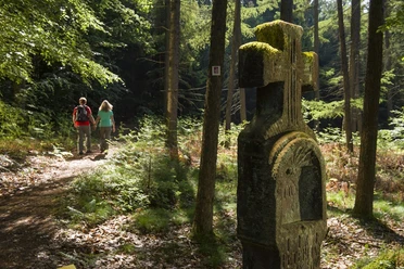
In the Steinbachtal nature reserve, the trail runs over many wooden bridges and numerous steps. It continuously ascends. The foliage of the trees barely lets sunlight into the narrow gorge. Thick moss grows on massive rock formations and on the surrounding deadwood. It is breathtakingly quiet in the valley.
The view from the Cloef viewpoint of Germany’s most beautiful river bend is especially impressive from the platform of the treetop walkway.
The path back to Mettlach leads over stone rushing water and rocky terrain to several viewpoints with picturesque views into the Saartal and the forested ridge with Montclair Castle.
The path has been rated with 82 experience points by the German Hiking Institute.
Ferry operating times:
April to October: daily from 10:00 a.m. to 5:45 p.m.
Monday closed
If Monday is a holiday, the rest day moves to Tuesday.
November and March: weekend operation only
Closed from December to February.
Good to know
Best to visit
Tour information
Cultural Interesting
Loop Road
Loop Road
Stop at an Inn
Author
Frank Polotzek
Organization
Saarland
License (master data)

Nearby


Download GPX file