Saxony M

- 19:10 h
- 281.32 km
- 717 m
- 694 m
- 80 m
- 209 m
- 129 m
- Start: Leipzig main station
- Destination: Leipzig main station
The bike route is approximately 285 km long and snakes in the shape of an "M" through the district of Nordsachsen. It starts in Leipzig and leads clockwise via the Elster bike path to Schkeuditz, via the Grüner-Ring-Leipzig bike path to Schladitzer See, on the KOHLE | DAMPF | LICHT | SEEN bike path to Delitzsch and then via the Torgau bike path through Bad Düben to Torgau. Then the route goes over the Elbe bridge and on the Elbe bike path on the right bank of the Elbe to the Elbe crossing with the ferry to Belgern, further on the Elbe bike path to Strehla and on the Mulde-Elbe bike path to Oschatz. On a section of the Döllnitztal bike path, cycling enthusiasts ride via Mügeln to Wermsdorf, Dahlen and Schildau and from there on the Dahlener Heide bike path to Wurzen. Finally, the bike route leads on the Mulde bike path from Wurzen to Eilenburg and via Taucha back to Leipzig.
The navigation is given for the route in clockwise direction. Of course, it is possible to choose a different starting point or to cycle the route in the opposite direction. Particular attention would have to be paid here to the changed route due to one-way streets or path routing.
More about bike routes in the Leipzig region: www.leipzig.travel/radfahren
Good to know
Pavements
- Street (16%)Asphalt (65%)Gravel (11%)Trail (6%)Path (2%)
Best to visit
- suitableDepends on weather
Directions
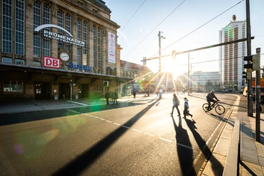
The bike route starts in Leipzig at the main station and leads along Richard-Wagner-Straße past Goerdelerring. At the intersection "Große Fleischergasse," turn left and follow the street to the New Town Hall. There you pass Martin-Luther-Ring and continue towards Johannapark. Following Johannaparkweg, you follow the route until shortly before Sachsenbrücke, where you turn right onto Max-Roger-Allee. Along the Elster riverbed, the bike path now continues straight ahead for a long time. In Rosenthal, the river splits into Weiße Elster and Neue Luppe. Here you follow Neue Luppe past Auensee to Schkeuditz. Through the center, the path leads to Schkeuditz station, where you keep right and follow Neue Hallesche Straße to the intersection with Radefelder Allee. Here turn left and cycle on to Radefeld. After passing Hayna, the route leads for a short stretch along Schladitzer See to Wolteritz. At the outskirts of town, turn left and reach Werbeliner See. The bike path now continues along Werbeliner See to Delitzsch. After passing the town center, you head north to Benndorf and then to Seehausener See. Along the lake shore, the path leads you to Löbnitz and further along the Mulde to Bad Düben. Arriving in Bad Düben, you cross Mulde bridge and cycle past St. Nikolai Church. You leave the spa town behind to the northeast and follow the bike path through Dübener Heide to Authausen. Via Pressel, Roitzsch, Weidenhain and Süpitz, you reach Torgau. After passing the town center, you cross the Mulde again and continue cycling via Werdau, Graditz, Pülswerda, Kathewitz and Köllitsch to Belgern. There you pass the Mulde bridge and continue towards Mühlberg/Elbe to Strehla. The route leads southwest through Oschatz, Mügeln, Wermsdorf, Dahlen and Hohburg to Wurzen. On the last stretch, you pass Thallwitz, Eilenburg and Jesewitz until you finally return from the northeast direction to Leipzig. Through the districts Thekla and Schönefeld-Abtnaundorf, you cycle on to Leipzig main station, where you reach your starting point.
Tour information
Loop Road
Stop at an Inn
Equipment
Bicycle helmet, rain and sun protection, provisions and water, bike lighting when dark.
Directions & Parking facilities
- Getting there
By car to Leipzig:
From Berlin via the A9 and A14, exit Leipzig-Mitte
From Dresden via the A14, exit Leipzig-Ost
From Munich and Erfurt via the A38, exit Leipzig-Südwest
ParkingLeipzig: Car park at the main station and Leipzig Zoo
Public transportationNumerous connections to Leipzig main station (regional and long-distance).
Very good transport connections from Leipzig main station to Schkeuditz, Delitzsch, Torgau, Oschatz, Dahlen, Wurzen, Eilenburg, Taucha (train or S-Bahn)
Additional information
More about bike routes in the Leipzig region: www.leipzig.travel/radfahren
Author
Christina Witt
Organization
LEIPZIG REGION
License (master data)
Christina Witt

Author´s Tip / Recommendation of the author
Due to the good public transport connections, the route can also be cycled in several stages or only partial sections can be ridden.
E-bike charging stations:
Leipzig: Leipzig Zoo, Auensee
Schkeuditz: Town hall square
Rackwitz: Schladitzer See
Bad Düben: Nature park house, Fahrrad Hammer, NaturSport-Bad
Torgau: Tourist information, Hartenfels Castle
Oschatz: Old market (Sporenstraße 16)
Wurzen: Bike shop at the market, tourist information
Eilenburg: Bike shop at the station
Safety guidelines
The route runs along the federal road for short sections.
Nearby



Download GPX file