- 1:45 h
- 6.33 km
- 75 m
- 75 m
- 191 m
- 263 m
- 72 m
- Start: Hiking Parking Lot Seifersdorf
- Destination: Hiking Parking Lot Seifersdorf
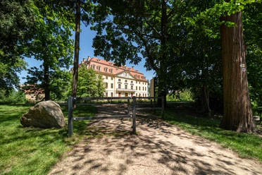
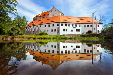
The approximately 6 km long Seifersdorfer Round not only leads hikers to cultural highlights of West Lusatia such as Seifersdorfer Castle and Valley but also to the Steinberg, a viewpoint with a historic Luther Cross, from which there is an excellent view towards Keulenberg. The route is especially suitable for families.
Pavements
- Street (1%)Asphalt (13%)Gravel (20%)Trail (17%)Path (50%)
Best to visit
- suitableDepends on weather
Directions
- The route starts and ends at the hiking parking lot in Seifersdorf (community of Wachau) in close proximity to Seifersdorfer Castle. From there, follow the yellow dot towards Marienmühle and Seifersdorfer Valley. In the valley, hike towards Grünberg up to Kunathmühle and from there back towards Seifersdorf. The path leads over Steinberg with the Luther Cross, from where there is a very nice panoramic view to Keulenberg. From Steinberg downwards, the path now runs to Seifersdorfer Castle, with a lovely park. A visit here is definitely worth it. After crossing the road S 177, you are back at the starting point.
Tour information
Cultural Interesting
Loop Road
Tour with Dog
Directions & Parking facilities
- Getting thereSeifersdorf can be reached via the A4 Dresden - Bautzen. At the Ottendorf-Okrilla exit, turn right towards Radeberg; Seifersdorf is the first town after the highway. The hiking parking lot is located a few hundred meters after the town entrance on the right side opposite Seifersdorfer Castle.ParkingAt the hiking parking lot in Seifersdorf, there are enough free parking spaces available.Public transportationComing by regional train from Dresden, Görlitz, or Zittau, you can transfer to bus line 317 (direction Ottendorf-Okrilla/Medingen/Grünberg) in Radeberg. Get off at the Seifersdorf Kirchgasse stop. You reach the hiking parking lot by walking about 100 - 200 meters back towards the castle. Across from the Seifersdorf is the access path to the hiking parking lot.
Author
Region Westlausitz
Organization
Das Landschaftswunderland Oberlausitz
License (master data)
Region Westlausitz

Map
Saxony Cartography - »Hiking and Cycling Map West Lusatia«, 1:33,000, ISBN 978-3-86843-018-9
Dr. Barthel Verlag - »Cycling and Hiking Map Bischofswerda, Pulsnitz, Stolpen and Surroundings«, 1:35,000; ISBN 978-3-89591-144-6