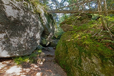
Hiking route 'Tanne' (Fir tree) (Mauth - Waldhäuser)


- 4:45 h
- 13.80 km
- 540 m
- 335 m
- Start: Mauth P+R, Reschbachstraße, 94151 Mauth
- Destination: Waldhäuser Youth Hostel, Herbergsweg 2, 94556 Neuschönau
The hiking route 'Tanne' (Fir tree) begins at the entrance of Mauth. Passing by the Große Kanzel, it leads to the Sagwassersäge and the National Park Centre Lusen. You'll walk through the Tier-Freigelände (Animal enclosure), where native animal species can be observed in expansive enclosures. Afterwards, the ascent to the mountain village of Waldhäuser begins, and the 'Tanne' (Fir tree) trail concludes at the Youth Hostel located there.
Good to know
Best to visit
- suitableDepends on weather
Contact person
Hans-Eisenmann-Haus
Nationalparkzentrum LusenBöhmstr. 3594556 NeuschönauAuthor
Nationalparkverwaltung Bayerischer Wald
Freyunger Str. 294481 GrafenauOrganization
Nationalparkverwaltung Bayerischer Wald
License (master data)