J8 - hike to the Pöhl dam


- 3:30 h
- 12.69 km
- 237 m
- 233 m
- 308 m
- 410 m
- 102 m
- Start: Jößnitz Castle
- Destination: Jößnitz Castle
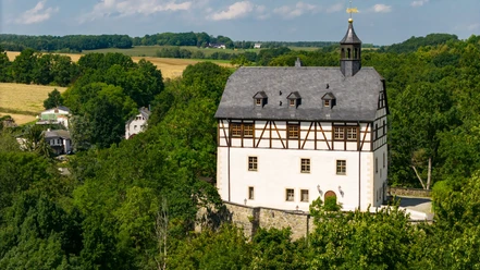
The route starts at Jößnitz Castle, leads through the Lohbach Gorge to the Barth Mill. We cross the Elster and continue our hike towards the bridge. After crossing the railway tracks, entering the Trieb valley opens up impressive impressions of landscape and natural forces.
We walk upstream along the Trieb River. When we reach the Loreley bridge, the mighty Loreley rock towers up, then it continues to the Pyramid Meadow. At the foot of the dam, there is a steep ascent, partly with steps, to the dam crest.
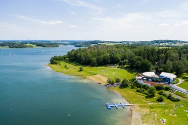
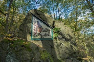
Our hike passes the 435-meter-high Eisenberg. After that, we reach the boat dock and the climbing forest. The return route goes via the Lochbauer, an old Vogtland three-sided farm with a timber-framed house from the 17th century, and through the Elster valley—past the Devil's Pulpit—and the Nymph Valley, with a short break at the Pfaffen Mill, back to Jößnitz.
Waypoints

Good to know
Pavements
- Unknown (22%)Street (16%)Asphalt (14%)Gravel (9%)Trail (26%)Path (13%)
Best to visit
- suitableDepends on weather
Directions
Route course: Jößnitz Castle – Fabrikstraße – Röttiser Straße – Lohbach Gorge – Confluence Döhlaubach/Lohbach – Barth Mill – Crossing White Elster – NSG Trieb Valley – Loreley Rock – Pyramid Meadow – Dam of Pöhl reservoir – Crossing the White Elster – Devil's Pulpit – Nymph Valley – Pfaffen Mill Path – Parish Path – Jößnitz Castle
After starting at Jößnitz Castle, the route initially leads through the Lohbach Gorge – a valley with untouched nature – and continues towards Barth Mill. Halfway, at the confluence of the "Döhlaubach" into the "Lohbach," it proceeds downstream along the river to the "White Elster." Right at the stop of the lower railway, the hiking trail runs towards the impressive Elster valley bridge into the Trieb valley, the core area of the Vogtland Switzerland.
The route begins at Jößnitz Castle, leads through the Lohbach Gorge, a part of untouched nature, following Lohbach and Döhlaubach, into Barth Mill. Here we get an extraordinary view of the Elster valley bridge structure before crossing the Elster and continuing the hike towards the bridge. After crossing the railway tracks, impressive impressions of landscape and natural forces open up upon entering the Trieb valley.
We walk upstream along the Trieb river course. On arriving at the Loreley bridge, the mighty Loreley rock towers up; the route continues to the Pyramid Meadow. There, covered seating groups invite you to rest and linger. At the foot of the Pöhl reservoir dam with the plunge pool, the steep ascent, partly with steps, leads to the dam crest. The dam was built from 1958 to 1964; it is 59 m high and 312 m wide.
The Pöhl reservoir offers various recreational possibilities. Our hike passes the 435-meter-high Eisenberg. There has stood the 14 m high Julius Mosen observation tower for over 100 years. Then we reach the boat dock and the climbing forest. The return route goes over the Lochbauer, an old Vogtland three-sided farm with a timber-framed house from the 17th century, and through the Elster valley—past the Devil's Pulpit—and the Nymph Valley, with a short break at the Pfaffen Mill, back to Jößnitz.
Tour information
Loop Road
Stop at an Inn
Additional information
In the Trieb valley, water bubbles left over huge moss-covered stones, and impressive rocks covered with old trees rise on the right.
Other dining options:
- Snack bar at the anchor spot, at the boat dock, Pöhl, April - October, Tel.: 0151 - 7055505
Author
Tourismus Marketing Gesellschaft Sachsen mbH
Bautzner Straße 45/4701099 DresdenOrganization
Vogtland - Sinfonie der Natur
License (master data)
Vogtland - Sinfonie der Natur

Author´s Tip / Recommendation of the author
Path of the trees in the immediate vicinity of the Lochbauer
Safety guidelines
ATTENTION!!!!!
a hiking trail below the Loreley rock is currently closed
Map
- The tourist information offices at the Pöhl dam campsite and in Jößnitz provide map materials for you.
Nearby



Download GPX file