On the nature trail to the summit of Lausche


- 2:55 h
- 9.05 km
- 415 m
- 418 m
- 398 m
- 775 m
- 377 m
- Start: Parking lot at Kirschhübel (behind the Quirle Häus‘l) in the resort Waltersdorf
- Destination: Parking lot at Kirschhübel (behind the Quirle Häus‘l) in the resort Waltersdorf
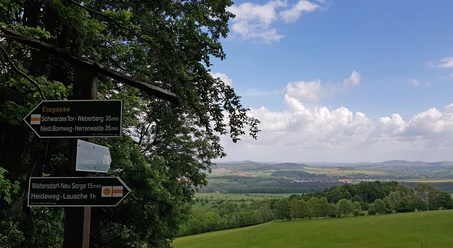
Starting at the Kirschhübel parking lot, you pass through the Nature Park garden heading west and reach the first of a total of 14 information boards along the nature trail marked with a green slash at the top. Via Sängerhöhe, you descend into the valley to Pfarrflössel. Here, the path leads left uphill towards Neu Sorge to the rest area with the millstone table. Via Heideweg and Neuen Weg, you continue uphill on the soft path or optionally take the parallel ridge path towards Lausche. At board 7, the nature trail branches off to Lausche. After this short detour, continue downhill past two mountain huts to the border crossing at the watch station. Now follow the Hohlsteinweg for about 100 meters and then turn left to reach the red quarry along Sonneberg. A root-covered path leads along the forest edge towards Oberdorf parking lot. Along Butterberg, continue to the Nature Park house and from there back to the starting point.
Good to know
Best to visit
- suitableDepends on weather
Directions
- Starting at the Kirschhübel parking lot, you pass through the Nature Park garden heading west and reach the first of a total of 14 information boards along the nature trail marked with a green slash at the top. Via Sängerhöhe, you descend into the valley to Pfarrflössel. Here, the path leads left over the small river and uphill again towards Eisgasse/Neu Sorge to the rest area with the millstone table. Via Heideweg and Neuen Weg, you continue uphill on the soft path or optionally take the parallel ridge path towards Lausche. At board 7, the nature trail branches off to Lausche. Since 2020, a viewing platform crowns the highest peak of the Zittau Mountains, allowing a 360° panoramic view. After this short detour, continue downhill past two mountain huts to the border crossing at the watch station. Now follow the Hohlsteinweg for about 100 meters and then turn left to reach the red quarry along Sonneberg. A root-covered path leads along the forest edge towards Oberdorf parking lot. Along Butterberg, continue to the Nature Park house and from there back to the starting point.
Tour information
Loop Road
Stop at an Inn
Equipment
- Trekking backpack, snacks and drinks, sturdy footwear, functional clothing, hiking poles, sun protection/rain protection, ID card, map material, in winter conditions spikes
Directions & Parking facilities
- Getting there
From Zittau via Bertsdorf on the S136 to Waltersdorf, turn left at the church onto the main road, follow it for about 500 meters, before the "Quirle Häusl" a short, steep climb leads directly to the parking lot
Coming from Großschönau via the S135, drive straight ahead at the church and then as described another 500 meters to the parking lot
ParkingFree parking lot for about 20 carsPublic transportation Additional information
- There is NO inn and NO kiosk on the Lausche; please provide your own refreshments or use the offers of the mountain huts
Author
Tourist-Information Großschönau/Erholungsort Waltersdorf im Naturparkhaus Zittauer Gebirge
Organization
Das Landschaftswunderland Oberlausitz
License (master data)
Tourist-Information Großschönau/Erholungsort Waltersdorf im Naturparkhaus Zittauer Gebirge

Author´s Tip / Recommendation of the author
- Nature Park garden with quiz, rest area at Pfarrflössel, Lausche summit, Butterberg playground, Nature Park house with interactive exhibition and quiz part 2
Safety guidelines
- From November to March/April, snow and ice slippery conditions must be expected especially in the area of Lausche.
Map
- Saxon cartography hiking and cycling map "Nature Park Zittau Mountains" ISBN:978-3-86843-039-4
Nearby



Download GPX file